The Great Snow Storm March 2023
The Great Snow Storm of March 2023
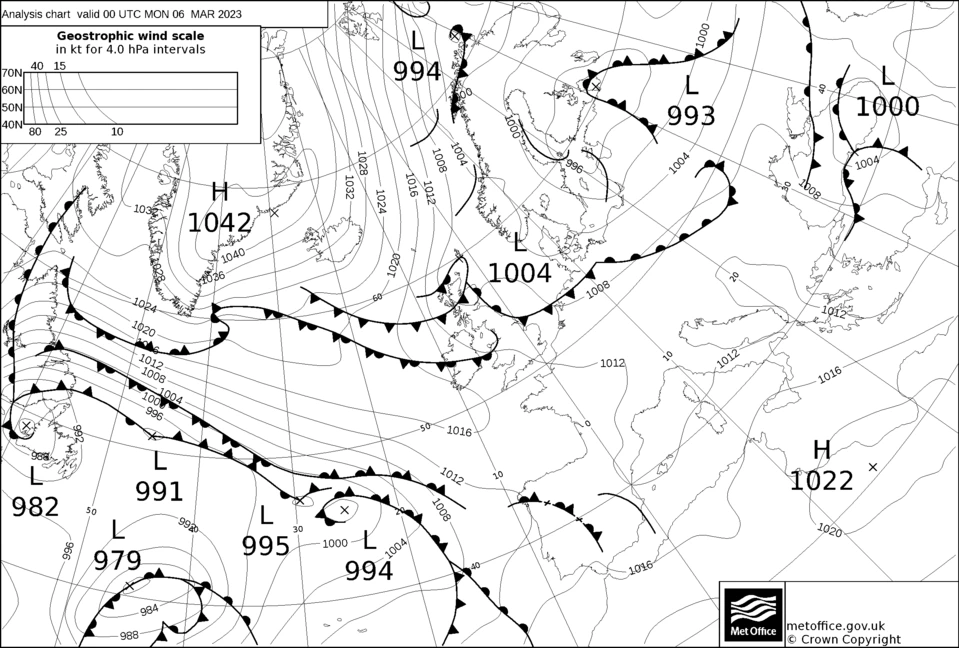
The cold spell of spring March 2023 when it began after a quiet fairly uneventful winter nobody would have thought we would be soon witnessing the first real Snow storm since November 2021 and a storm that closely matched anything that December 2010 threw at us. The storm actually consisted of two separate weather systems which effectively merged when the second system named Storm Larissa by the French met Office which caught up and eventually merged with the first system. There were two cold outbreaks the first one to the 5th to the 6th which produced some light flurries before milder air returned ahead of the main cold push on the 6th which is the one I'll concentrate on.
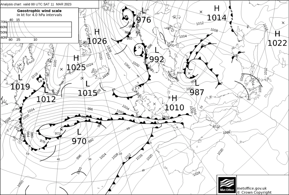
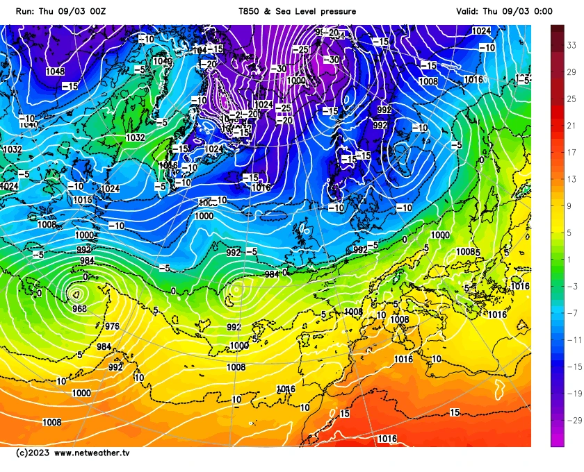
The main cold air started working it's way south on the 6th, see the fax charts below, reaching the south of the UK by the 7th. The cold front bringing change had some back edge snow developing as it moved south although for us the Pennines prevented the rain mostly coming across to the east and what fell was rain which died away while areas in the south of England saw Snow from this system. The upper air temperatures were a cold -5 over England with to -10 just edging into Scotland. Generally over most of the UK and Ireland the upper air values were -7 to -8. This is the temperature at approximately 5000ft. The UK was now set for the old classic battle of the Atlantic mild air v The cold Arctic air.
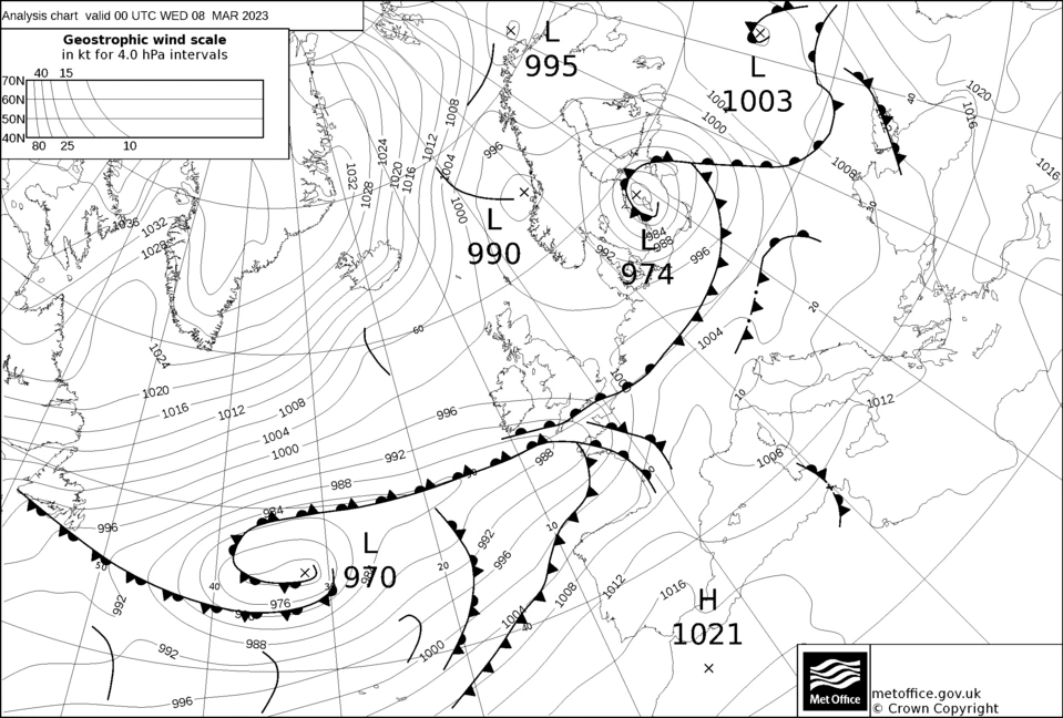
The first battle started on the 8th as a warm front moved slowly North finally reaching the area around lunchtime on the 8th. The push north was further than expected and increased speculation whether the next system would also also push further north. The models GFS, ECM and all struggled with this placing Storm some showing a rapid push north others further south keeping us cold. The warm front produced some light to moderate Snow. This struggled to settle away from the lawns and pavements and roads stayed generally clear. This would have been due to high ground temperatures and a lack of any prolonged frosts. The Snow continued through the afternoon of the 8th and although more showery in nature overnight into the 9th.
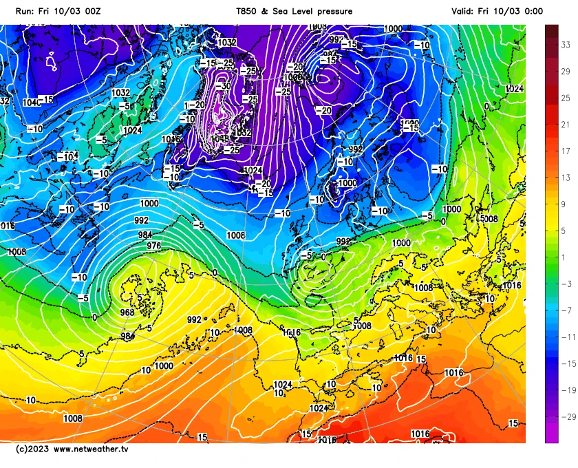
By evening of the 8th the models still weren't sure of the exact path and the difference generally about 50 to 100 miles and a small drift north of south would have an impact on the weather in Sheffield. The milder air would pushing over the cold and it was possible for the Snow to turn to rain and introduce freezing rain instead which was also a risk. The range of 850 temperatures was very steep over the Sheffield region.
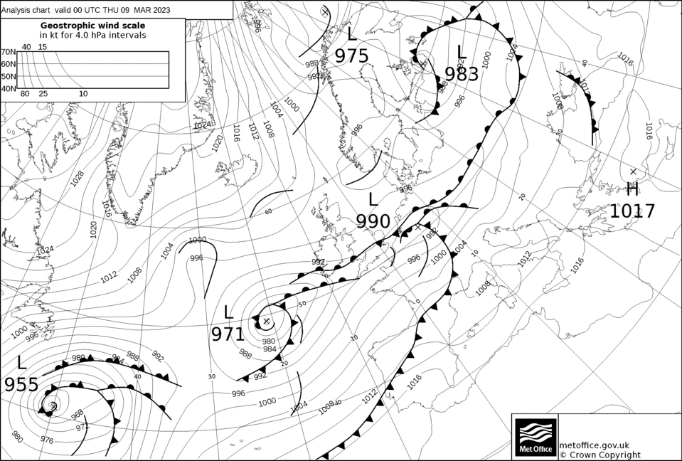
The 9th dawned with light Snow 5cm of Snow on the grass the snow quickly turned heavier but in areas low down struggled to settle and the increase in depth was slow. The snow was moderate to heavy by midday and was beginning accumulate nicely on higher ground from about 160m and higher. The low pressure at this time was over Northern Ireland with the fronts and warmer air still pushing North.
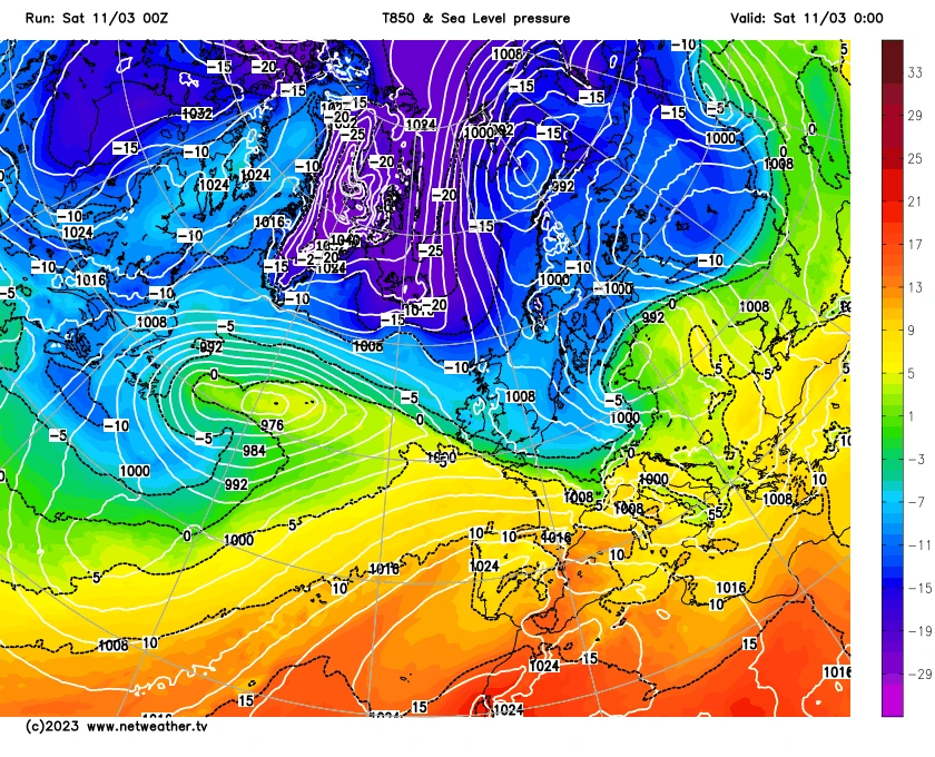
The Snow became more showery in the afternoon with some heavier bursts as pulses of heavier precipitation pushed north east merging with the main area of Snow over the region. The low The late afternoon saw the Snow turn to sleet in Chesterfield as milder air got very close to Sheffield. In the evening heavier precipitation arrived turning the sleet back to Snow in Chesterfield and it slowly worked it's way north eastward with push of mild air halted. The depth of Snow in the evening round 160m was about 8cm. The roads with any height were difficult to drive not helped again by the poor response of Sheffield Council which had 2010 all over it once again. The low pressure at this time was slowly tracking SSE from Northern Island towards the south of England. Accumulation was slow still however very heavy Snow arrived overnight. The low by midnight would be close to the south coast allowing colder air to push southwards again as the associated fronts pushed SSE.
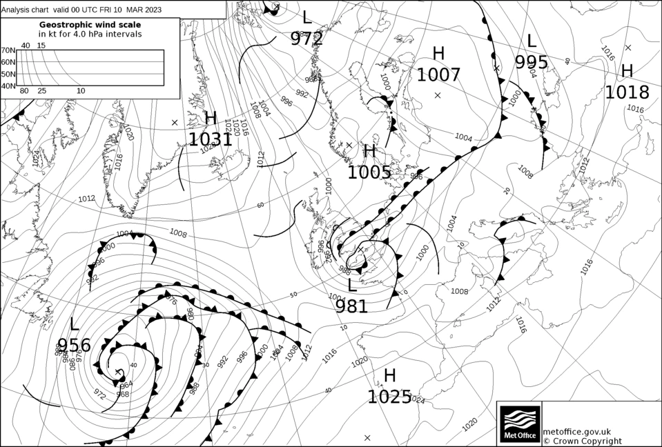
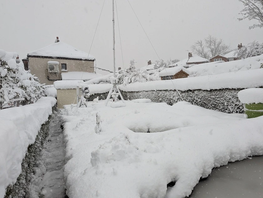
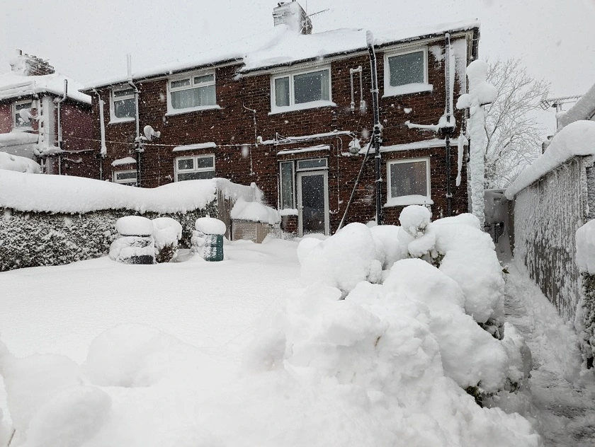
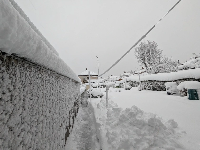
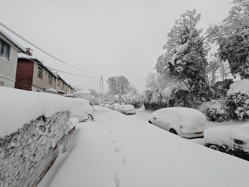
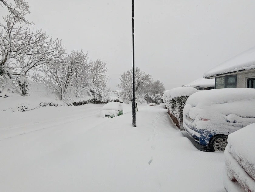
The morning of the 10th revealed a world under deep snow. Snow depths of 30cm to 31cm made getting to work extremely difficult and dangerous and with the present hospital status foot hardy to attempt. Although not quiet matching the depths of November to December 2010 when the depths reached 40cm the amount of precipitation was higher in a shorter time period. The snow was also wetter and therefore more compact. Later water measurements revealed that if the Snow was dry like in 2010 the depth would have been similar even possibly deeper. Snow depths higher up reached 50cm and higher. The snow soon died away during the morning with sunny spells leaving people to dig themselves out. The Low pressure moving away from the south east into northern Europe fairly steadily with the Snow clearing from the south east later in the morning. The Snow like in November 2021 stopped the analogue Anemometer from working but the Ultra sonic continued reading. The rain gauge was buried as was the soil thermometer.
Saturday saw a dry morning with sunny spells and a depth of 27cm in the morning the sunshine not producing a rapid thaw as expected. The Afternoon was cloudy with more light to moderate Snow in the evening which turned to rain overnight. Sunday was a mild day with sunny spells rapidly reducing the Snow as the day went on.
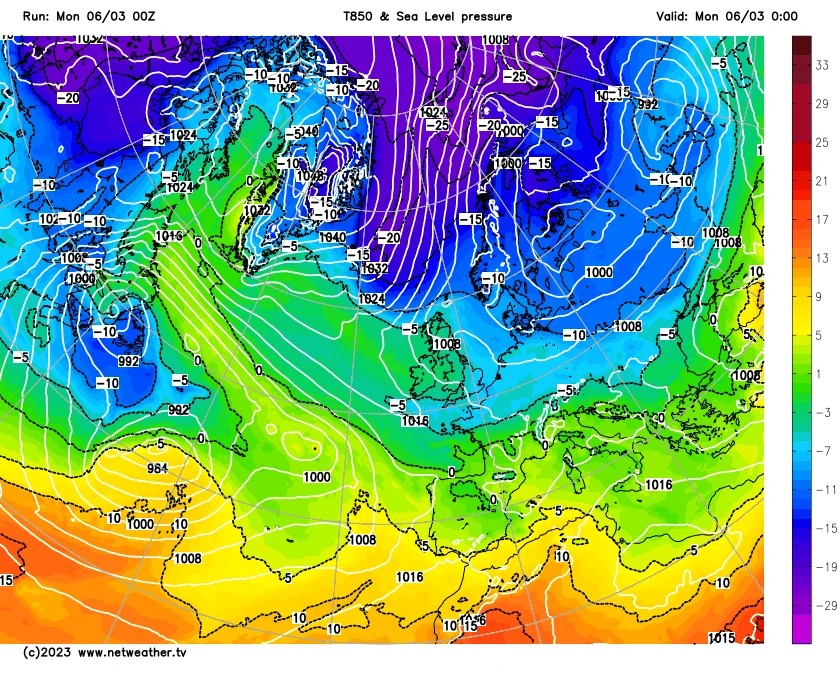
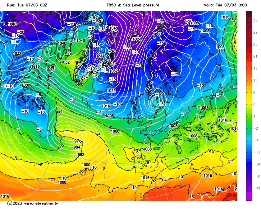
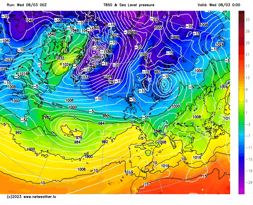
The six UK Met Office fax chart images below show the cold spell and the storm developing and it's path across the UK into Europe. Followed by the GFS 850 Sea level Charts for the same time period.

The Met Office Forecasting and Local Council response.
The forecasting was pretty good considering how the models were fairly uncertain even close to the event. The Met office yet again failed to name the storm this time French met office did the honours calling it Storm Larissa. The uncertainty was clearly announced and explained. The warnings for once did reflect the conditions perhaps under doing it slightly.
The Council response was again poor. Although they did grit early on when they were actually needed they were found wanting. Only the fact that the cold spell was short and temperatures were higher allowed them to get away with it otherwise we'd have been looking at another 2010. No doubt in the coming weeks we shall see the council gritting heavily for slight frosts as they did earlier on in this month.
The public responded better where in 2010 many waited in vain for the council to do something people were generally out clearing the snow from the side roads which was good too see in one sense.
The pictures below show the conditions locally.
Comparison to March 2013 and the Beast from the East 2018.
The cold March 2013 was longer lasting and also record breaking in terms of cold. March 2013 had two cold snaps One from the 9th until; 14th which produced no lying Snow and a long cold spell from the 18th to the 31st. The 22nd saw 16cm fall taking the depth to 18cm which was deepest. The whole setup was different with this being a easterly based flow and also much much colder. The month also recorded an ice day with a high of only -0.3C. The Snow was also dry in nature and much easier to handle.
The Beast from the East of 2018 was actually two beasts from the east. The first started in February and lasted into the 4th of March. The Snow depth on the 1st was 18cm. The next day saw 12cm of Snow as it compacted and also blew away. By the 5th the Snow had mostly gone. The cold snap was a three day Mini Beast from the East which produced two ice days -0.4C on the 17th and -0.9C on the 18th. 16cm of Snow had fallen by the 17th however by the 20th the Snow had gone. The cold spells of 2018 were colder but produced much less in the way of Snow. The Snow produced mostly in the form of showers as well rather than organised bands of Snow.
Nether of the these cold spells produced a single storm they were longer lasting generally and much colder.