Cloud Types
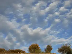
Mid Level Clouds Alto Cumulus
Alto Cumulus are mid level small clouds clouds called cloud-lets. These form layers or patches in the form of rounded clumps. Unlike Cirrus they are mostly composed of droplets although some ice crystals maybe present. They tend to be white or grey and the sides away from the sun are shaded. The shading is the difference between Cirrus Cumulus

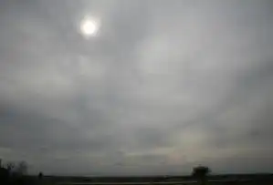
Altostratus
This type of cloud develops as thin layer of cloud from gradually thickening veil of cirrostratus which then descends. They consist of a mixture of water droplets and ice crystals. If the cloud is thin enough in parts the sun may be visible however it won't be able to cast any shadows.. The clouds tend to cover large areas of the sky and are featureless in nature. Often seen ahead of a warm front or an occluded front and may thicken into nimbostratus when the front passes. These clouds can be a indication that the weather is about to change.

Nimbotratus
Nimbostratus are medium level clouds that tend to be gray in color and are associated with heavy continuous rain or Snow. The clouds tend to be featureless and can be thick enough to block out the sun. Located between 2000ft to 10000ft. Nimbo stratus are not associated with Thundery storms, Hail though.
